Google Street Views
The following three Google street views are of the Old Rerrick kirkyard, Dundrennan Abbey and Auchencairn cemetery respectively:
First and Second Statistical Accounts of the Parish
Side by Side Mapping
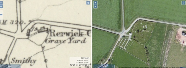
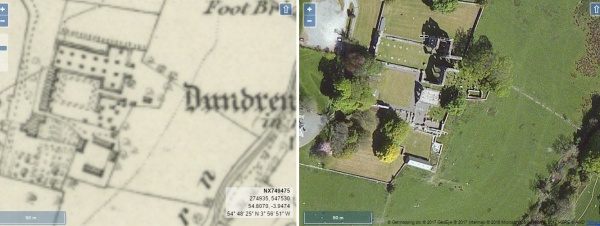
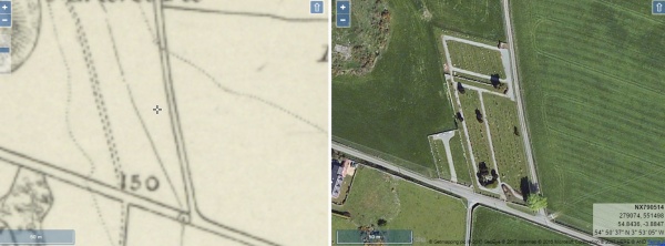
The website of the National Library of Scotland has a fascinating map viewer. Clicking on an images shown below will open a page showing an early Ordnance Survey map showing the burial ground alongside a modern satellite view of the same area. Once open, the maps can be scrolled and zoomed and different map combinations can be selected.
Rerrick old kirkyard
Dundrennan Abbey
Auchencairn Cemetery
The Parish of Rerrick. The Parish of Rerrick occupies an area of 20,447 acres of land, which includes some of the finest and most unspoiled coastal scenery in Galloway. Rugged cliffs, heughs, sheltered bays and spectacular caves all feature in the landscape and were the scene of much smuggling activity in the 18th Century. Most of the landward area is arable and the rest consists of woodland, moorland and waste ground. The distinctive gently pointed summit of Bengairn rises to 1200 feet, providing a vantage point from which to enjoy fine views of the whole of the parish as well as a distant panorama of the Lake District hills.
As in the rest of Galloway, the number of people engaged in agriculture has fallen during the 20th Century due to increased mechanisation and many former farm cottages have in consequence become holiday homes, or homes for retired people. The Ministry of Defence requisitioned a large area of coastal land during the Second World War and that land continues to be used, both as a military and a civilian training area. The resulting lack of access to the coastline is greatly regretted by most people, and the frequent sound of heavy explosions and gunfire is at times disturbing and has raised concerns about environmental pollution. The lack of public access has however protected much of the land from other unattractive development and in recent years public access has been restored to as many parts of the land as possible so that walkers, ornithologists and geologists are once more able to appreciate at least some of its charms.
The two main settlements are the villages of Auchencairn and Dundrennan. Auchencairn is beautifully sited at the head of Auchencairn Bay and is an attractive old village of some charm, retaining a village school, a public house, a church and a community shop. A considerable community feeling exists and the recent construction of a number of new houses has expanded the population and may help local businesses to develop. The smaller village of Dundrennan is linear in form, and its modest buildings overlook the impressive ruins of the Cistercian Abbey of Dundrennan, standing among trees on the bank of the Abbey Burn. Dundrennan has sadly lost its public house and its school, and has not profited from much expansion in its housing stock in recent years. It slumbers peacefully on however, hopefully awaiting a time when its beautiful setting and its magnificent Abbey attract both more visitors and some new residents.
There is little employment in the parish apart from in agriculture and the tourism industry so growing numbers of people commute to Kirkcudbright, Castle Douglas, Dalbeattie and Dumfries.
David R. Collin 2010


